The PR-V 183 begins in the municipality of Xeraco.
From the town centre of Xeraco we look for the national road, to cross it by the bridge and there we will find the beginning of the route. From the town centre we look for the national road, to cross it by the bridge and there we will find the beginning of the route. Going up this road, along an asphalted road, you will reach a flatland 3 kilometres away where you will find some irrigation tanks, the ideal place to park the vehicles and continue on foot.
The first few metres of the route go along a poorly maintained road and slowly we enter the mountain, in order to get to Mondúver. In a few minutes, and after 1 km of walking, you will reach an area of recreation located in the same Font de l’Ull. From now on and to the right, we climb a steep slope, where after a few metres we reach la Font de l’Olivereta. The path becomes a path that runs through el Tossal Redó. From this point, an ascent of 800 metres in length brings us la Caseta Don Carlos.
Thus, we begin the descent through the vegetable garden, which is the point where we will make the entire route in a circular way, turning where we have come from in order to reach the end of the route. At this point, the path goes up in zigzag, with a very important difference in level. For this reason it is not advisable to do this PR (little walk) in the opposite direction, as the descent would be a bit dangerous. This area is called l’Escaleta, a space of greater difficulty.
The ascent ends in a plan. Take the path to the right and go down in the direction of la Font de l’Escudella. We will cross the small ravine of the fountain where the path steeps, in just one kilometre we will find an asphalted forest trail: the old Barx path. Turn right, and after 1.5 km until getting to a deviation to the right, along a narrow path of stones we start the path to el Pla de les Esmoladores. At this point, we must be cautious, because we will take a small path to the right that will lead us along the hill bordering mont Piló (mount Piló).
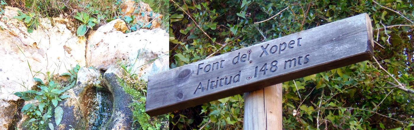
After about 3 km of descent, the path becomes a citrus grove path, which we will follow for about 1 km until we cross la Font del Xopet path, where we turn right. This road will stop being asphalted and after 3 km it will leave us in front of la Font del Xopet. After a few hundred metres we will reach the terrace, where we have passed at the beginning of the route. From this point on, we will turn left and drive the 3 km of the route again, but in the opposite direction, until we reach the beginning of the route.