There was a small operative garrison during the Mudejar uprising led by Al-Azraq.
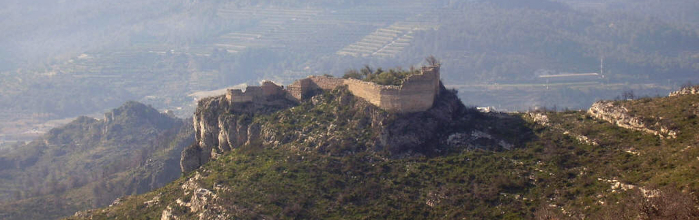
It is located on a large rounded crag at 142 metres of altitude, about two kilòmetres to the northwest of the town, overlooking the strategic coll de Llautó, between la Serra de Benicadell i la serra de Cuta, a few metres from the municipality of Llutxent, and within the region of La Vall d’Albaida. It is easy to pass through this hill from la Vall d’Albaida to la Safor, hence the presence of the fortification.
Few documents have survived to this day that speak of Vilella; the most important would be the mention of el Llibre dels Fets del rei Jaume I, where it is explained that this castle was linked to that of Bairén, on which it depended before the Christian conquest. Shortly afterwards, in the second half of the 13th century, it was named by Bazzana and Guichart, from whom it is known that there was a small garrison operating there during the Mudejar uprising led by al-Azraq.
With the pacification of the territory the castle remained between the dominions of Llutxent and Palma, losing its strategic and military function and interest during the first moments of the feudal conquest. The castle of Vilella remained abandoned forever.
The constructive characteristics of this fortress and other archaeological evidence allow us to think that it was an Andalusian castle, probably built at the end of the Muslim dominion of these lands, at the end of the 12th century or the beginning of the 13th century.
The castle of Vilella has an enclosure of medium size, 2,038m2 of surface, with a simple structure formed by rectilinear segments that define an interior space.
The general structure has an elongated shape with a dominant east-west orientation, formed by a thick wall that has seven metres in height at some points. In the northern part on the slope is the access to the enclosure. This entrance is formed by a rectangular tower about four metres high, with two opposing doors to make access difficult.
In the eastern direction, the wall reaches only a few metres, having disappeared much of its route in the eastern and southeastern sectors, precisely to the highest and steepest part of the crag where the castle is located.
In the north-west part, the fortification is defined by large mudwalls with a thickness of approximately 1.20 m that go on until the entrance tower. Just at this western end of the enclosure attached to the perimeter wall is a rectangular structure with two doors, one to the south and the other to the east, and two loopholes open to the west, a compulsory pass to enter the castle. This space could have been a defensive tower with the purpose of controlling the access.