We find ourselves in front of a fortification from the Muslim period that appears referenced to El Llibre dels Fet (the Book of Acts), by James I.
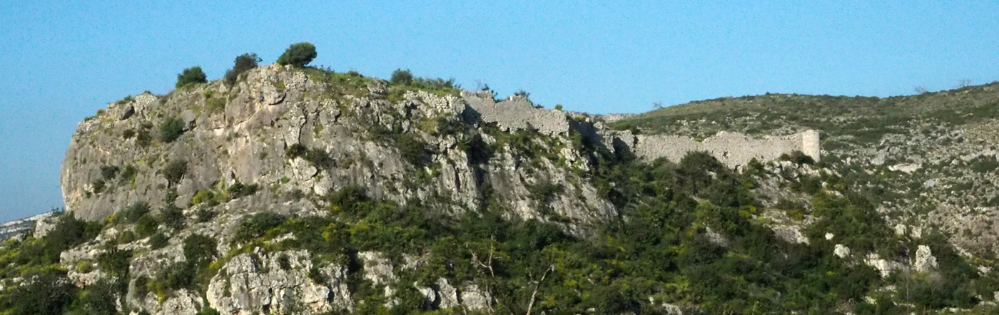
The castle is located at the top of a 240 metres high crag surrounded by several crags, such as la Penya Esclusa to the west, el Picaio to the northeast, la Planícia to the north and l’Alto de la Planícia to the east. On the east and west side, two ravines called Blanco and Atanassi go down, respectively, leading to Vernissa River, which is to the south of the castle.
Just as the castles of Vilella, Palma and Vilallonga, Borró will be linked to that of Bairén.
The walled enclosure had about 3,700m2, and it does not seem to have gone through any substantial change after the Christian conquest. Today we can still see the end of the path, which will bring us to it, the first round tower built with masonry and with a large loophole pointing towards us. To the north side of the tower and continuing eastwards there is a large and long wall, half overthrown, which we suppose must have been the only access to the castle.
On the eastern side of the entrance, a square tower of medium size and another wall of approximately one metre width is built, which continues eastwards, following the relief and taking advantage of the cliff as a natural defence. A tower that has now disappeared, from which the remains of the foundation can be seen, is located on the eastern side of the rock, symmetrically located in relation to the other round tower in relation to the centre of the platform. In the central part of the walled enclosure are some constructions made of adobe of a smaller width, except for the cistern which has wide walls to prevent water from filtering through.